Artificial Intelligence &
Geospital Analytics
At L Arkkitehdit, we advance our practice—and the entire construction sector—through hands‑on, project‑tied research and development. We believe lasting change is created in collaboration with clients and partners, and our goal is to deliver added value at every stage of the building process. Our earlier development has focused on streamlining BIM and algorithm‑assisted design. Today, we are especially exploring the potential of artificial intelligence and geospatial data to support property development and architectural design.
The development of our AI tools is part of a project funded by the European Union – NextGenerationEU.

Artificial Intelligence
Our AI work currently focuses on two areas that strengthen the quality and efficiency of architectural design:
- developing intelligent assistants for knowledge management, and
- generative solutions that accelerate visual sketching and concept design.
With these tools, we can bring together up‑to‑date information, efficient ideation and creative design into one seamless workflow. We believe this holistic approach improves both the quality of design and how ideas are communicated to project stakeholders.

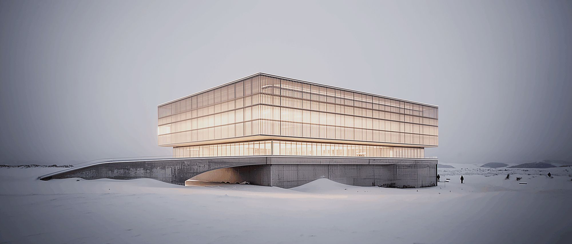
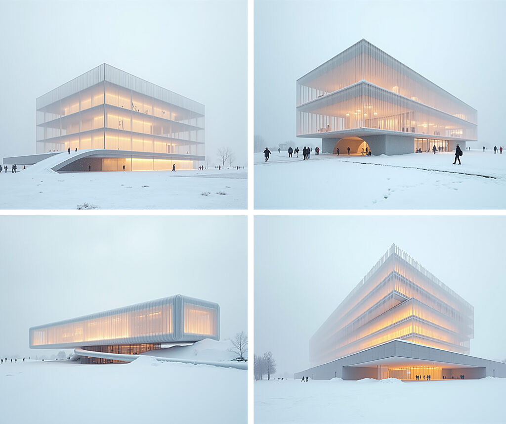
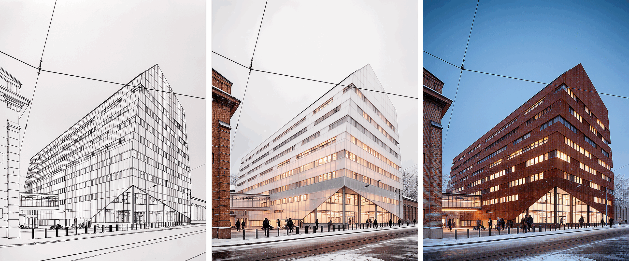
1. Muusa – our image generation tool
Muusa is our visual virtuoso: it turns sketches into visuals in an instant, freeing experts’ time to explore the best options.
Muusa combines multiple AI models, machine learning and computer vision with custom code and algorithms. We have fine‑tuned it to boost the critical, fast‑paced early phase of project development. The tool supports concepting and sketching by visualising ideas immediately, acting as a creative sparring partner for architects and enabling side‑by‑side comparisons to support decision‑making.
Muusa was born from L Arkkitehdit’s own development project funded by Business Finland, with the goal of delivering more value and quality to our clients by bringing the latest technology into everyday design practice.
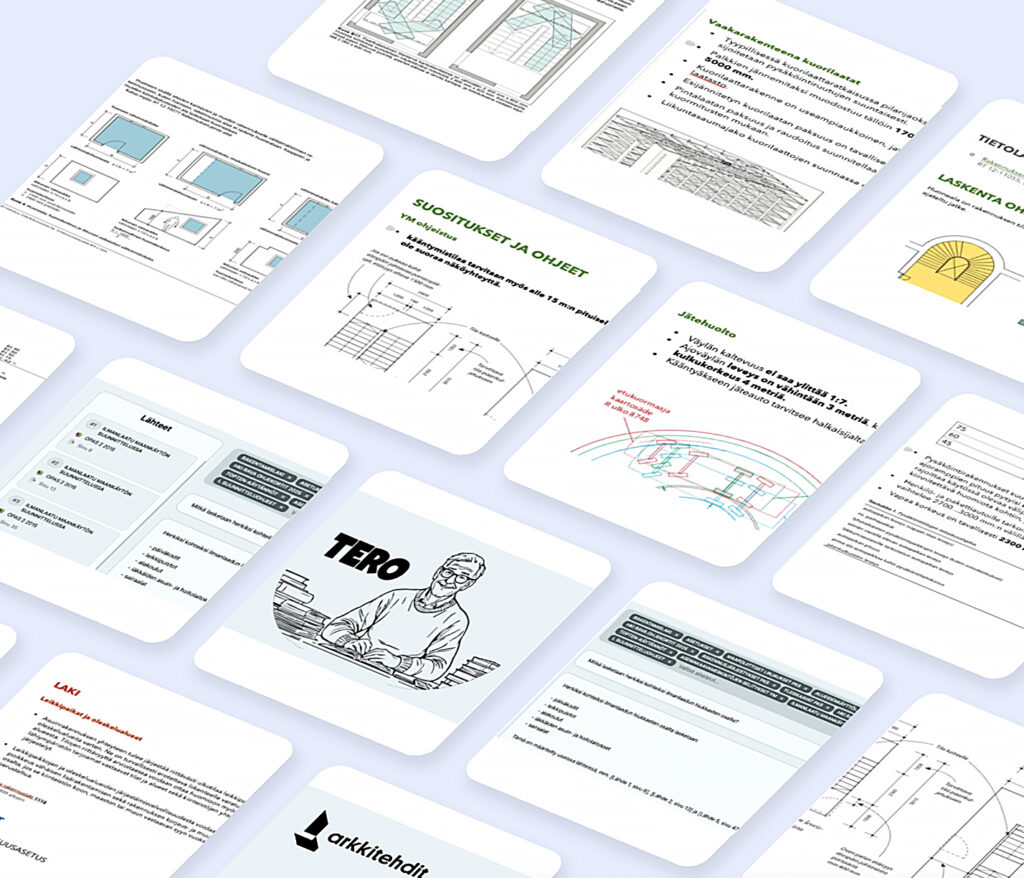
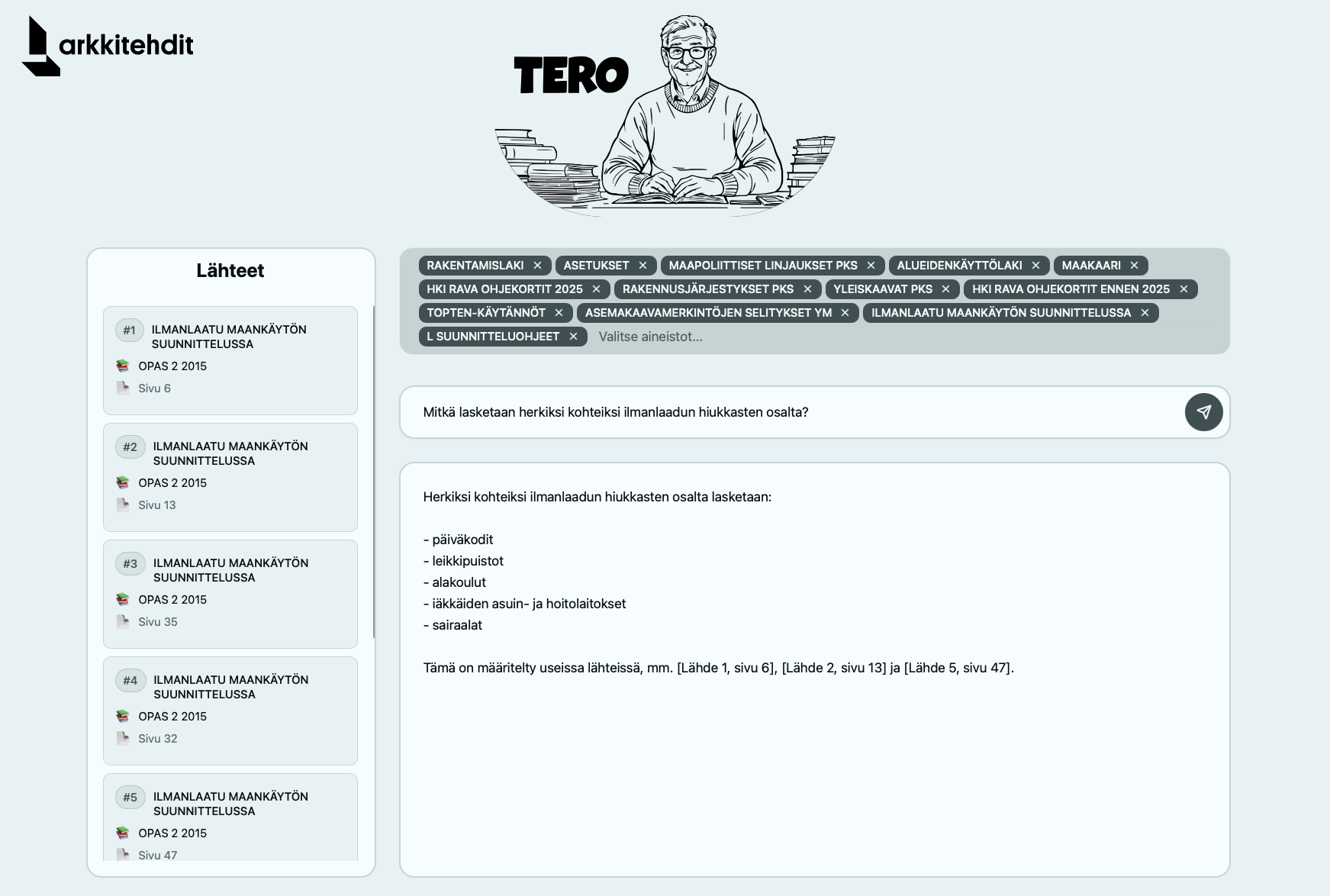
2. Tero – our AI assistant
Meet Tero, our newest AI assistant. Tero is a pragmatic yet helpful character—one who loves regulations, standards and rules—so that our team and clients can spend more time designing and less time worrying.
The assistant is an intelligent search tool based on a RAG (Retrieval‑Augmented Generation) model. We have fed it with a comprehensive body of sector regulations and norms along with our office’s extensive internal guidelines.
The tool supports us in meetings, at the design desk, and whenever we need hard facts instead of gut feeling.
Tero has been coded for us by Tommi Markkanen (Tachion Oy), who specialises in AI‑based tools for consulting firms.
Geospatial
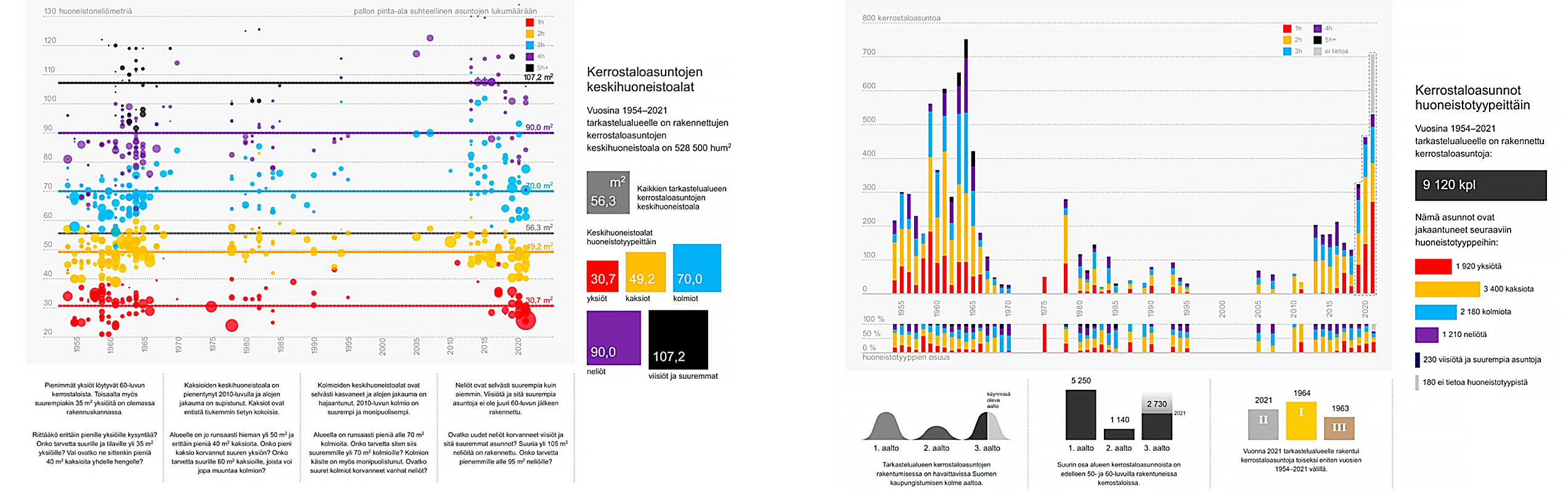
We are a strategic partner in urban and property development and Finland’s leading producer of geospatial analysis in the field of architecture. We deliver comprehensive, GIS‑ and expert‑analysis‑based insights to support project development and property and urban development. Our services include zoning and plot analyses, land acquisition support through plot search services, analytics based on demographic data, and other decision‑guiding studies.
Our philosophy is data‑driven, investigative design: the best solutions arise from robust analysis and a clear framework. Working closely with clients, we gather the necessary information and apply geospatial and data analytics so projects are well‑founded and sustainable. Geospatial data offers a broad view of a project’s context and its role in urban development.

1. Geospatial analysis to support design
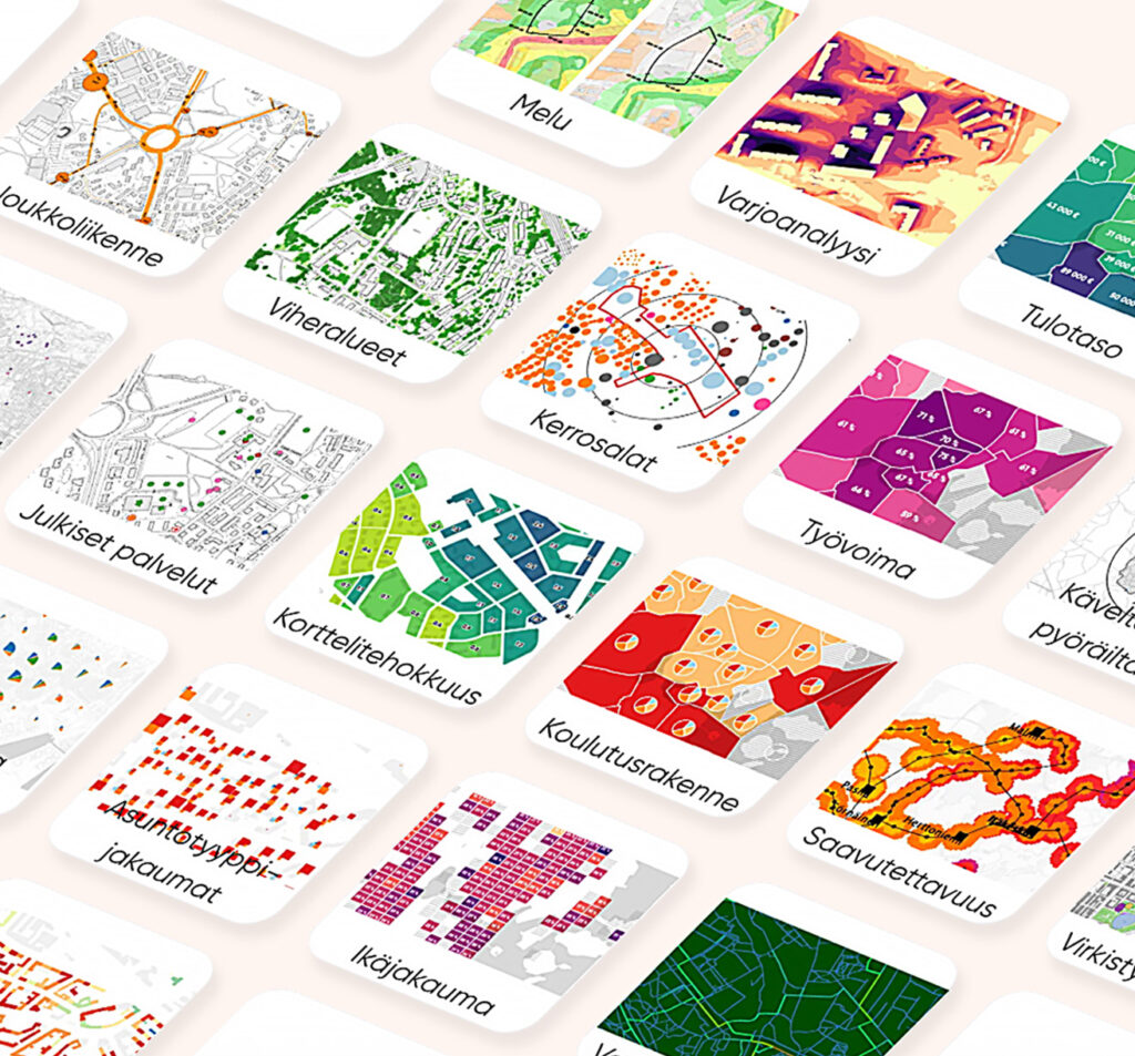
Finland and L Arkkitehdit are forerunners in geospatial work. Finland’s GIS capability is rooted in a long tradition of land‑use research; at L Arkkitehdit, it is backed by deep expert experience. Public bodies produce extensive open geospatial data for land‑use studies and planning. In addition, we collect and combine datasets and refine them into analyses that support urban development and design.
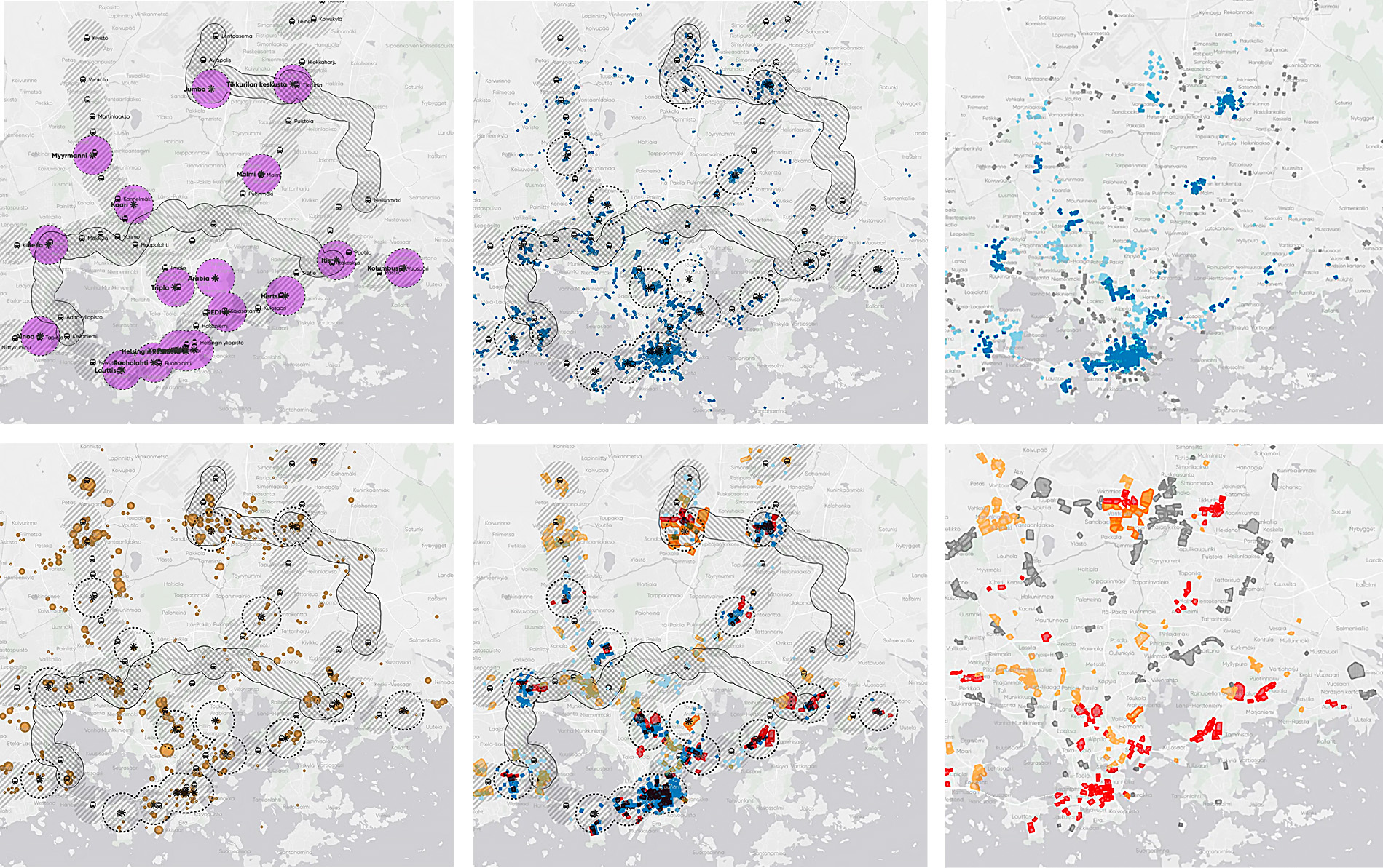
Geospatial analyses provide an efficient way to obtain decision‑guiding insight ahead of design. We assess a site’s suitability, attractiveness and development potential through, for example, zoning information, building and housing stock, socio‑economics, accessibility, service networks and environmental values. The results are compiled into a clear summary for the client and for use in design.
Because every project is unique, we tailor each analysis package to the needs of the site. This way we offer evidence‑based, perspective‑broadening reasoning throughout a project’s phases.
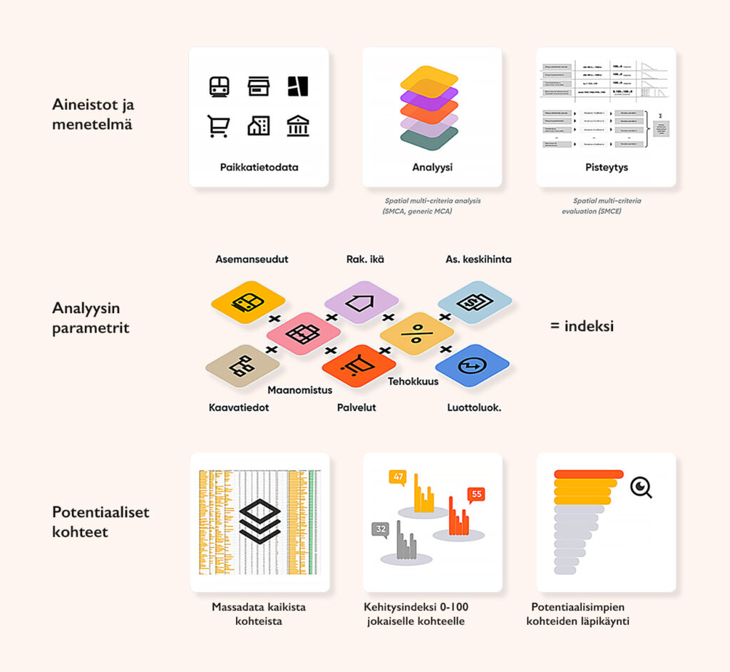
2. Plot Potential Index
Our Plot Potential Index combines GIS, computation and expert assessment to identify opportunities for urban development.
The analysis begins with mapping the zoning reserve, determining what current plans enable for different uses. It then evaluates applicable plans and locations—for example, in terms of services and accessibility. Finally, individual locations are examined at a micro level together with our experts.
The outcome is a clear, visual overview of development potential across areas. It can be used in strategic planning, resource allocation and investment decisions. By combining data and expertise, the analysis makes urban development more targeted and impactful.
“Good architecture is built on analysis, not trends.”
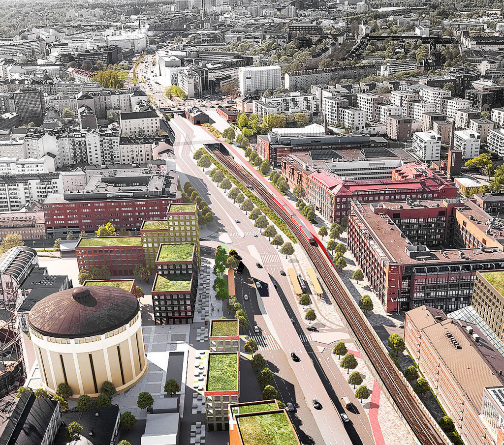
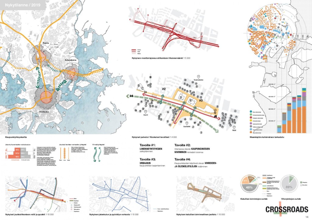
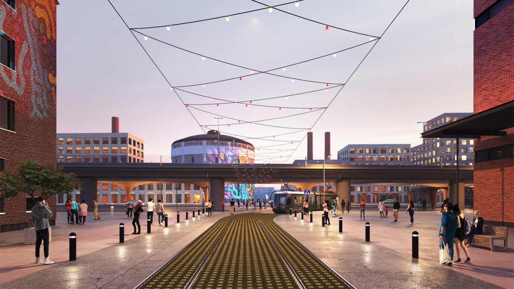
Case Junatie
In cities, accessibility and connectivity are essential. In the Junatie area studies, we examined the accessibility of the urban structure and identified the pain points that disrupt connectivity. By analysing street‑level activity together with, for example, the material‑based classification of street spaces, we gradually defined a framework that all design solutions had to follow.
The Junatie project is an invited‑competition win, based on which we prepared an urban plan for the Junatie and Teollisuuskatu area as part of the area’s master framework. The result is a plan that significantly improves connectivity, turns problematic traffic solutions into urban space, and increases the calculated amount of urban greenery. It also strengthens the conditions for urban culture through clearer public spaces, enabling vibrant shared activities across Suvilahti and Teurastamo.
More about Junatie here.
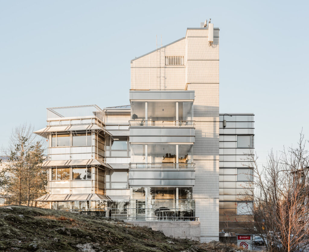
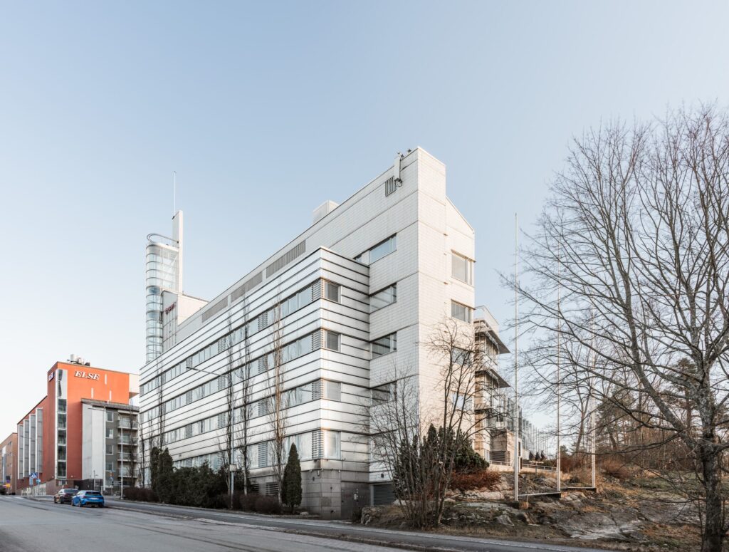
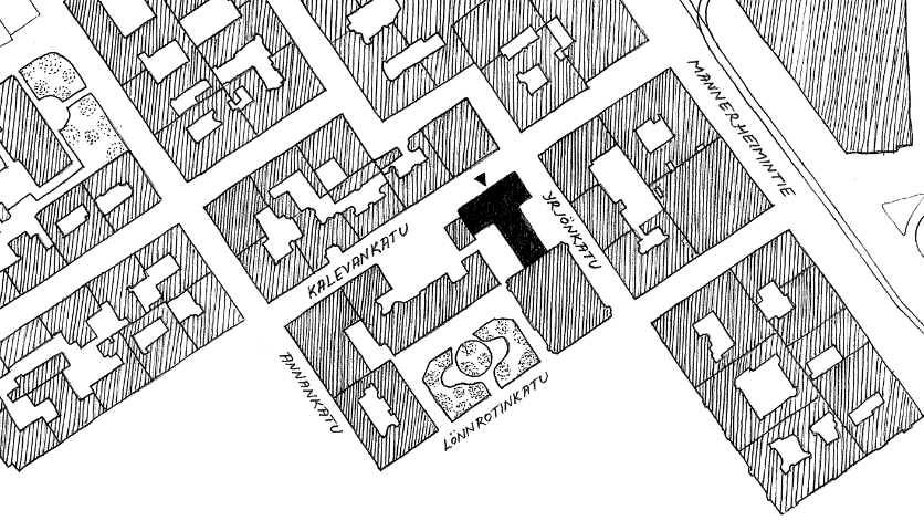
Case Herttoniemi
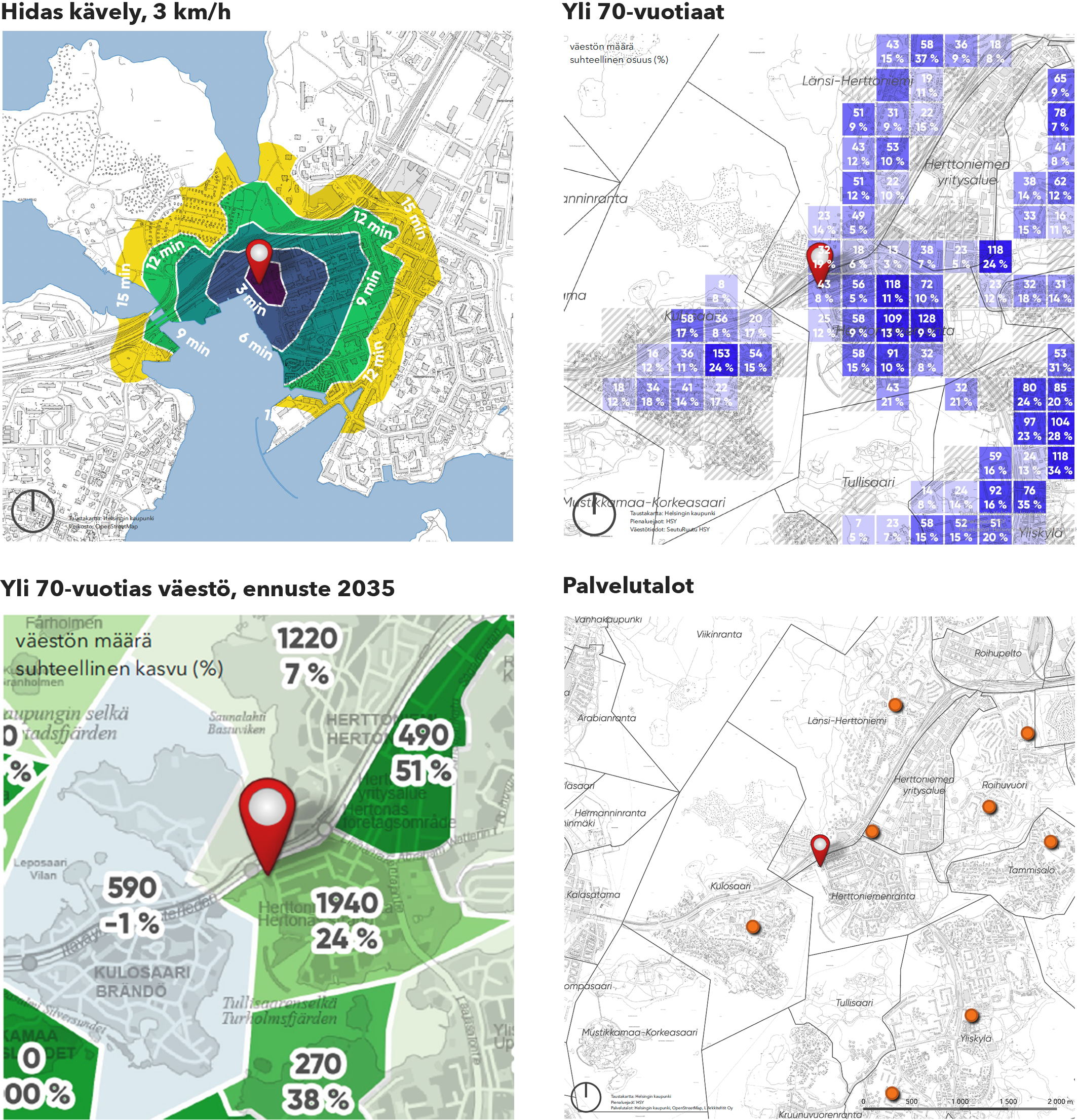
An ageing population means that service buildings form a key typology in the future building stock. But where should they be located? Together with the client, we prepared an area analysis that overlaid the existing service network and identified a new life for an existing office property through a change of use.
In Herttoniemi, we analysed accessibility (employees) as well as, for example, the area’s age distribution, income levels and ageing forecasts. The existing office building at the corner of Suolakivenkatu and Hitsaajankatu proved to be a perfect location for a future investment. Data analytics played a key role in the deviation decision, by which the property was converted to a service building without a zoning change.
More about Suolakivenkatu here.